 PROPIEDAD EN VENTA
Est. mensual: $16,987 Recalcular
Acerca de esta propiedad
Otra propiedad residencialNúmero de MLS: #41857
Four S Land & Cattle5,078 +/- acres
Water rights for approximately 407 acres - to be verified with Baker County Watermaster
Quality, practical ranch improvements
Includes 2 homes, shop, calving barn, working corrals w/ hydraulic chute
Contiguous ranch that allows for 'out the gate' turnout to spring and summer pastures
Alfalfa fields attract deer and elk resulting in quality hunting opportunities
Borders National Forest land for further recreational opportunities
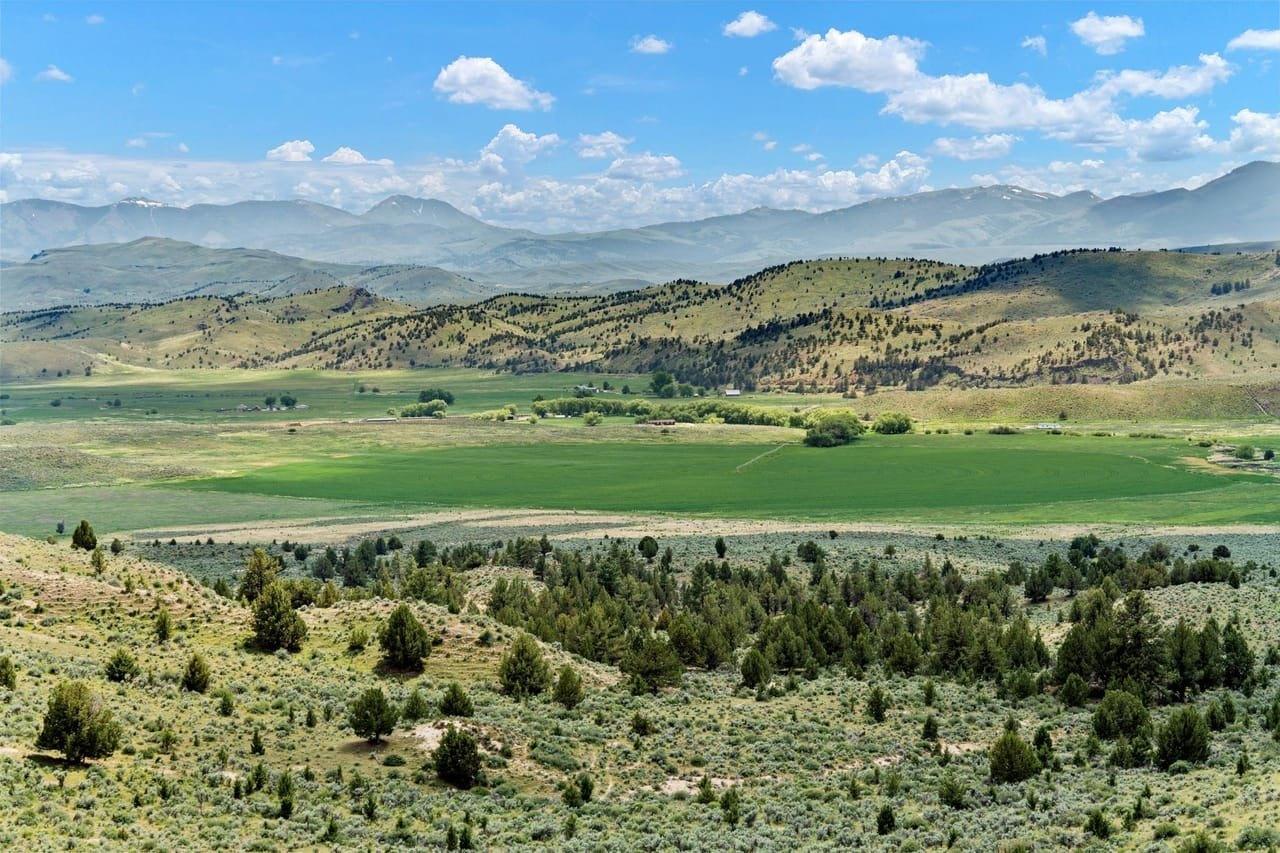
Four S Land and Cattle Ranch is a 5,078 +/- acre contiguous ranch that features a mix of over 400 acres of irrigated pastures & alfalfa fields, along with timbered hills filled with cedar, pinon, & juniper that work their way north into the Blue Mountains. The mixed landscape of timbered hills and alfalfa meadows also provides an ideal habitat for elk, deer, and other game that can be found throughout the ranch. Improvements include a newer manufactured house, a ranch hand house, shop, a calving barn, & working corrals with hydraulic chute. Alfalfa is grown on approximately 80 acres under center pivot and approximately 70 acres under two wheel lines.
Water
The ranch has irrigation water rights for just over 400 acres is sourced from both the Burnt River and the North Fork of the Burnt River. Cottonwood Creek and Beaverdam Creek flow through the ranch from north to south before they enter the Burnt River. Livestock water in the range pasture is provided by two spring fed stock ponds, a solar well that feeds 8 water troughs, and numerous undeveloped springs and seeps. Buyers to verify water rights information with BRID. District Manager Shawn Klaus - (541)-446-3313
Climate
Baker County experiences a semi-arid climate characterized by distinct seasons and relatively low precipitation. The region typically enjoys warm and dry summers, with temperatures reaching into the 90s Fahrenheit during the peak of the season. Winters are cold, with temperatures often dropping below freezing, and occasional snowfall is common. Spring and fall are transitional seasons with mild temperatures, though frost can occur in the early and late parts of these seasons. Overall, Baker County has a climate that lends itself well to outdoor activities and the enjoyment of the natural beauty of the area.
Area History
The area around Hereford was originally inhabited by Native American tribes, including the Paiute and Nez Perce. In the mid-1800s, as pioneers ventured westward during the Oregon Trail era, Hereford became a stopping point for travelers and settlers. The abundant natural resources, including fertile land and water sources, attracted people to the area.
Hunting, Fishing & Recreation
Ranch is located in the Sumpter Hunting Unit and qualifies for 5 Landowner Preference Tag applications for both deer and elk. Excellent fishing opportunities for trout, crappie, bass, and more in Unity Reservoir which is about a mile from the ranch. Anthony Lakes Mountain Resort, located 45 min from Baker City, provides skiing, snowboarding, and snowshoeing trails for all skill levels. Recreational enthusiasts will appreciate the nearby proximity to Monument Rock Wilderness, Strawberry Mountain Wilderness, and North Fork John Day Wilderness Area.
Distance To:
Unity, OR: 7 miles
Baker City, OR: 40 miles
John Day, OR: 52 miles
Pendleton, OR: 136 miles
Boise, ID: 147 miles - nearest commercial airport
Bend, OR: 204 miles
Co-marketed with Mirr Ranch Group.
Características de la propiedad
| Amenidades: | Puerto |
|---|---|
| Estilo arquitectónico: | Otro |
| Área del lote: | 5,078 Acres |
Copyright © 2025 LandLeader. All rights reserved. All information provided by the listing agent/broker is deemed reliable but is not guaranteed and should be independently verified. Information being provided is for consumers' personal, non-commercial use and may not be used for any purpose other than to identify prospective properties consumers may be interested in purchasing.
Los comentarios sobre la propiedad se emplea traducción computarizados. La traducción es automática y es solo una aproximación al contenido original proveído del sitio web. La traducción no se debe de considerar exacta ni basarse en ella. No asumimos responsabilidad por la exactitud de la traducción.
Escuela primaria
BURNT RIVER SCHOOL
4.5
MillasVer detalle
Escuela secundaria (ciclo básico)
BURNT RIVER SCHOOL
4.5
MillasVer detalle
Escuela secundaria (ciclo superior)
BURNT RIVER SCHOOL
4.5
MillasVer detalle


