
 PROPIEDAD EN VENTA
Est. mensual: $566 Recalcular
Acerca de esta propiedad
Otra propiedad residencialNúmero de MLS: #11241476
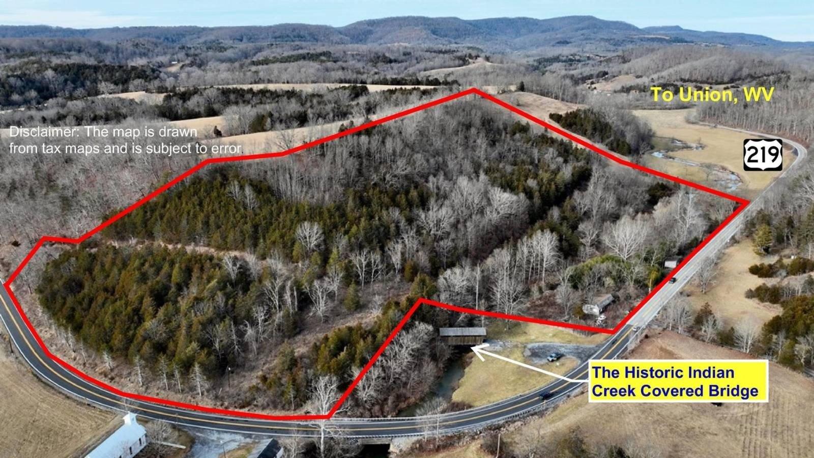
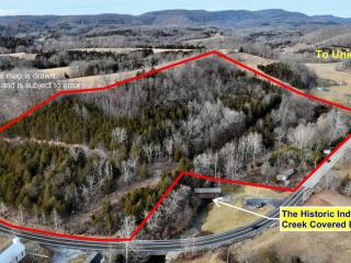
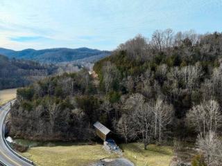
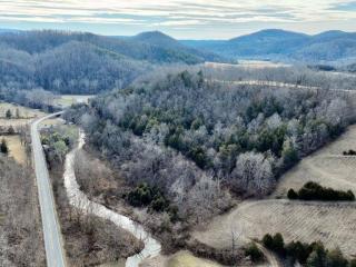
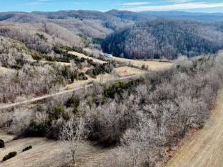
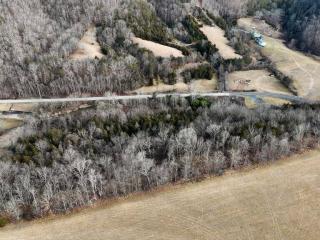
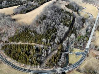
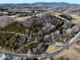
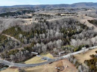
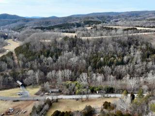
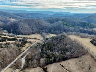
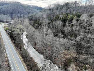
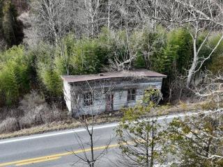
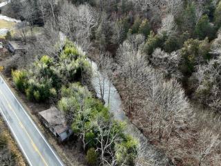
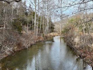
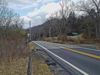
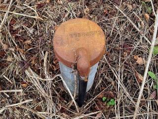
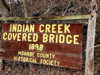
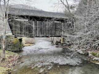
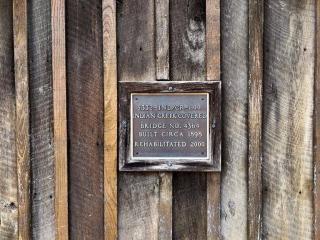
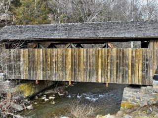
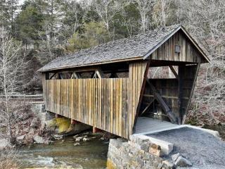
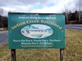
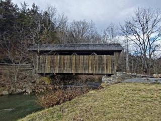
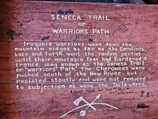
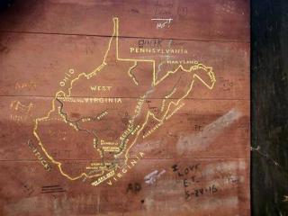
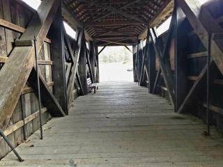
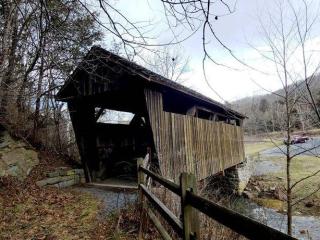
24 Acres of land with wonderful Indian Creek flowing through the tract. Old Covered Bridge Farm is located adjoining a WV Landmark, the historic Indian Creek Covered Bridge. This property has so much to offer for recreation and potential building sites. The property is an overgrown farm/land tract with two teardown buildings. The property has a drilled well and likely a septic, which both are unknown as to being usable. About 1000 feet of Indian Creek does flow through the property (both sides of the creek). The property is located near historic Salt Sulphur Springs and is only a few minutes from the county seat of government in Union, WV. The property taxes for 2023 were $465.00 for the year. Monroe County does not currently have county-wide zoning. The area is home to a vast selection of wildlife including trophy whitetail deer, black bear, wild turkeys, and all sorts of smaller game. INDIAN CREEK Indian Creek takes its name from a Native American trail that crossed the Appalachians from the Ohio River valley to the Great Valley of Virginia. "It was the interstate of the Indian world." Indian Creek is a tributary of the New River. It is one of Monroe County's main drainage basins. Indian Creek begins its journey near Salt Sulphur Springs and drains tens of thousands of acres on its winding 30-mile-long trip through pastoral farms, steep mountain canyons, wide bottomland forests, wetlands, and marshes before ending its trip close to Crumps Bottom, where it enters New River. From there, the New River flows to the Kanawha, onto the Ohio, then the Mississippi, and terminating in the Gulf of Mexico. It is said that the waters of Indian Creek will arrive in the Gulf of Mexico 3 to 4 days after entering the New River. SALT SULPHUR SPRINGS Salt Sulphur Spring near Union is a popular wedding venue and is the scene of select community events. The area is well known for the healing waters of the numerous "Sulphur Springs." During the 1800s and early 1900s, several "Sulphur Springs Resorts" flourished in the area. White Sulphur Springs, Warm Springs, and Hot Springs are most notably and still in existence. Others included Sweet Springs, Blue Sulphur Springs, Red Sulphur Springs, Green Sulphur Springs, Pence Springs, and Sweet Chalybeate Springs. During the height of wealthy families' summer treks to the Virginia Springs resorts from roughly 1800 until the Civil War one popular circuit encompassed "the fountains most strongly impregnated with minerals, heat, fashion, and fame," according to one chronicler. For those arriving from eastern Virginia and points northeast, the circuit started at Warm Springs northeast of Lewisburg in the Allegheny Mountains. From there, it ran south and west to the Hot, the White Sulphur, the Sweet, the Salt Sulphur, and the Red Sulphur, then back in the opposite direction. The "Old Salt" was famed for its three springs: sweet, salt sulphur, and iodine, curative especially for "chronic diseases of the brain" such as headaches. The main hotel building dates to about 1820. Salt Sulphur Springs Historic District holds one of the largest groupings of pre-Civil War native stone buildings in West Virginia. HIGHLIGHTS Located on the waters of beloved Indian Creek 24 Acres by deed Approximately 1000 feet of Indian Creek on the property Approximately 1600 feet of frontage on US Route 219 Excellent hunting and wildlife viewing Adjoins the property of the historic Indian Creek Covered Bridge owned by the Monroe County Historical Society Tremendous opportunity for cabins, dream homes, or commercial buildings Easy direct access from US Route 219 ATV, UTV the property Historic Union is only a 10-minute drive No deed restrictions Low property taxes LOCATION Google Coordinates: 37.547293°(N), -80.575018°(W) Address: 20117 Seneca Trail South, Union, WV 24983 Elevation Range: 1761 ft. to 1937 ft. +/-Características de la propiedad
| Amenidades: | En la costa |
|---|---|
| Estilo arquitectónico: | Otro |
| Área del lote: | 24 Acres |
| Tipo de tejado: | Desconocido |
| Ver tipo: | Montañas |
Copyright © 2024 My State MLS. All rights reserved. All information provided by the listing agent/broker is deemed reliable but is not guaranteed and should be independently verified. Information being provided is for consumers' personal, non-commercial use and may not be used for any purpose other than to identify prospective properties consumers may be interested in purchasing.
Los comentarios sobre la propiedad se emplea traducción computarizados. La traducción es automática y es solo una aproximación al contenido original proveído del sitio web. La traducción no se debe de considerar exacta ni basarse en ella. No asumimos responsabilidad por la exactitud de la traducción.
| Otros escuelas cercanos | Distancia | Tipo | Grados/años | Califaciones |
|---|---|---|---|---|
| Mountain View Elementary & Middle School | 3.1 mi | Public | PK-8 | C+ |
| Monroe County Vocational Center | 6.3 mi | Public | 9-12 | |
| James Monroe High School | 6.4 mi | Public | 9-12 | B |